UN votes to adopt new world map that shows Africa’s true scale
· World
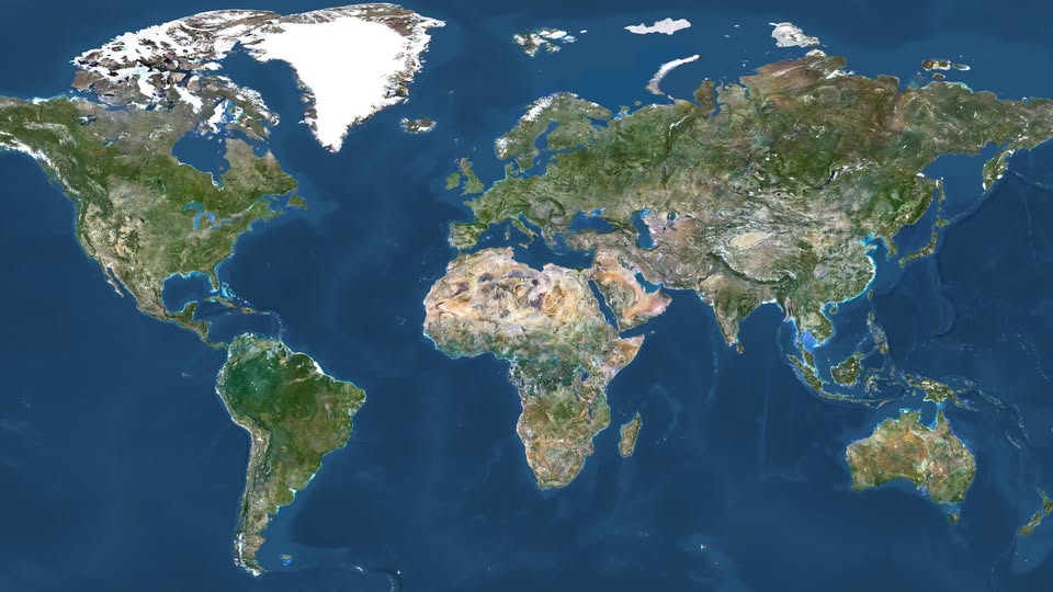
The United Nations General Assembly has voted overwhelmingly in favour of a resolution supporting a shift away from the traditional Mercator world map in favour of map projections that more accurately represent the size of continents, particularly Africa.
A total of 164 countries voted in favour of the resolution, while the United States voted against it and six countries abstained. The resolution promotes the use of the 2018 Equal Earth projection, an equal-area map designed to provide a more accurate representation of the world’s landmasses.
The Mercator projection, created by Flemish cartographer Gerardus Mercator in 1569, was originally designed for maritime navigation. However, its distortion increases toward the poles, making countries and territories in northern regions appear much larger than they actually are.
One of the most striking examples is Greenland, which appears comparable in size to Africa on many Mercator maps. In reality, Africa is about 14 times larger than Greenland.
Supporters of the change say the widespread use of the Mercator projection has influenced how people perceive the relative size and importance of different parts of the world. Togo, which led the campaign on behalf of the African Union, argued that the distortion has had lasting educational, cultural and geopolitical effects.
The #CorrectTheMap campaign has promoted the Equal Earth projection as a more accurate alternative and has received backing from the African Union.
The resolution is not legally binding, meaning countries, schools and technology companies are not required to abandon the Mercator projection. However, supporters expect it could encourage changes to educational materials, digital mapping platforms and other widely used representations of the world.
France has also announced that it will move away from the Mercator projection, opting instead for the Eckert IV projection, which similarly provides a more accurate representation of land area.
Supporters describe the decision as more than a cartographic change, arguing that accurately portraying the size of Africa and other equatorial regions could help challenge long-standing perceptions shaped by distorted world maps.
Togo's Foreign Affairs Minister Robert Dussey said the issue was ultimately about recognising scientific accuracy and changing the way the world is represented.
The move could mark a significant shift in how future generations learn about the planet — replacing a centuries-old navigation-focused map with projections designed to show the world's land areas more fairly.
Source: https://www.theguardian.com/